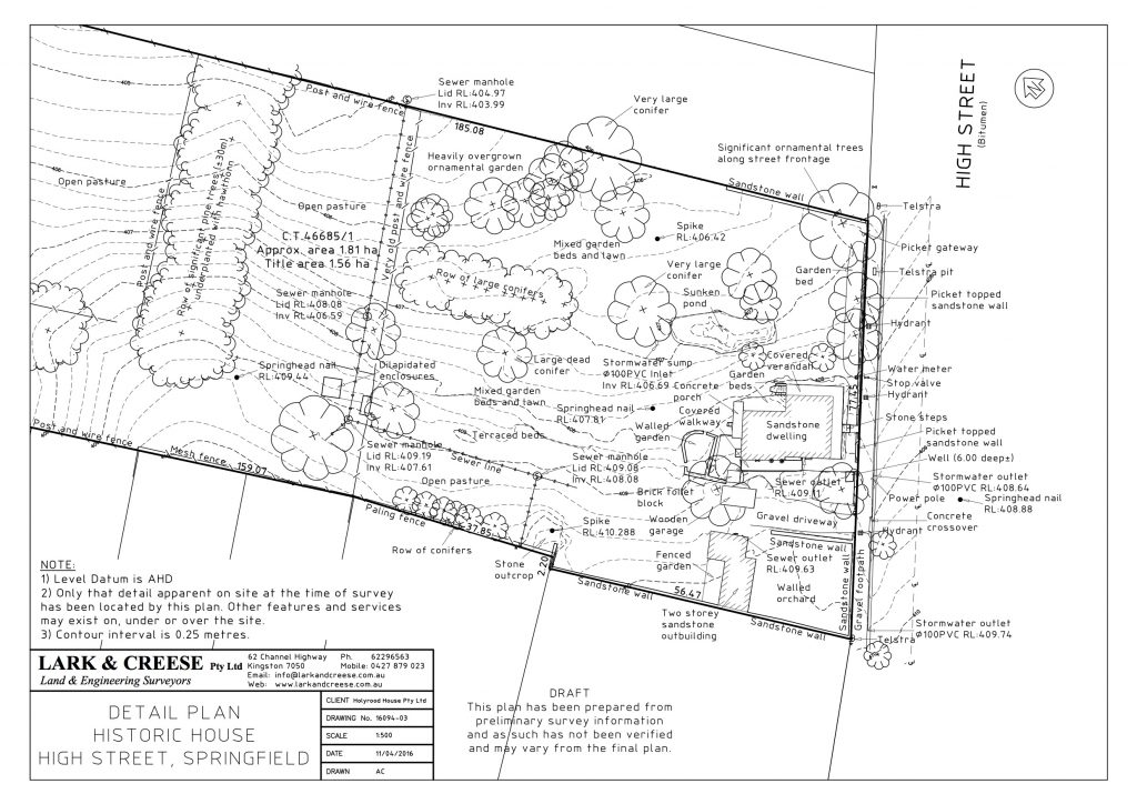
 Detail or contour surveys assist engineers, architects and building designers in the design process. They can be in the form of 2 or 3-dimensional models and capture;
- Built structures
- Natural features
- Surface levels
- On-site services
They are also often required by Councils as part of development applications to ensure compliance in terms of site gradients, building heights, overshadowing and servicing.
Lark & Creese also provide survey for dam design, stockpile movements, hydrological modelling, flood analysis and 3D sun-shadow diagrams.
As-constructed surveys locate development infrastructure and services for integration into Council’s Geographic Information Systems. They are also carried out upon completion of a project to provide proof of completion or to identify areas of non-compliance with construction standards.


